
Have you ever tried to describe a place to someone, but “near the big lake” was too vague? Latitude and longitude solve that problem. They give Earth a simple address system, like grid lines on a giant globe.
Think of Earth like a giant orange. Once you add a set of imaginary lines, any spot has a clear location. That’s what these numbers do. If you can read them, you can find places on paper maps, on apps, and in GPS.
In this guide, you’ll get latitude and longitude explained simply at an 8th-grade level. You’ll learn what the lines mean, how to read the coordinates, examples for real places, a short history, and a few myths people repeat. Then you’ll see how the same idea shows up in everyday tech.
Now let’s picture the grid that makes it all click.
Picture Earth as a Grid: Meet Latitude and Longitude
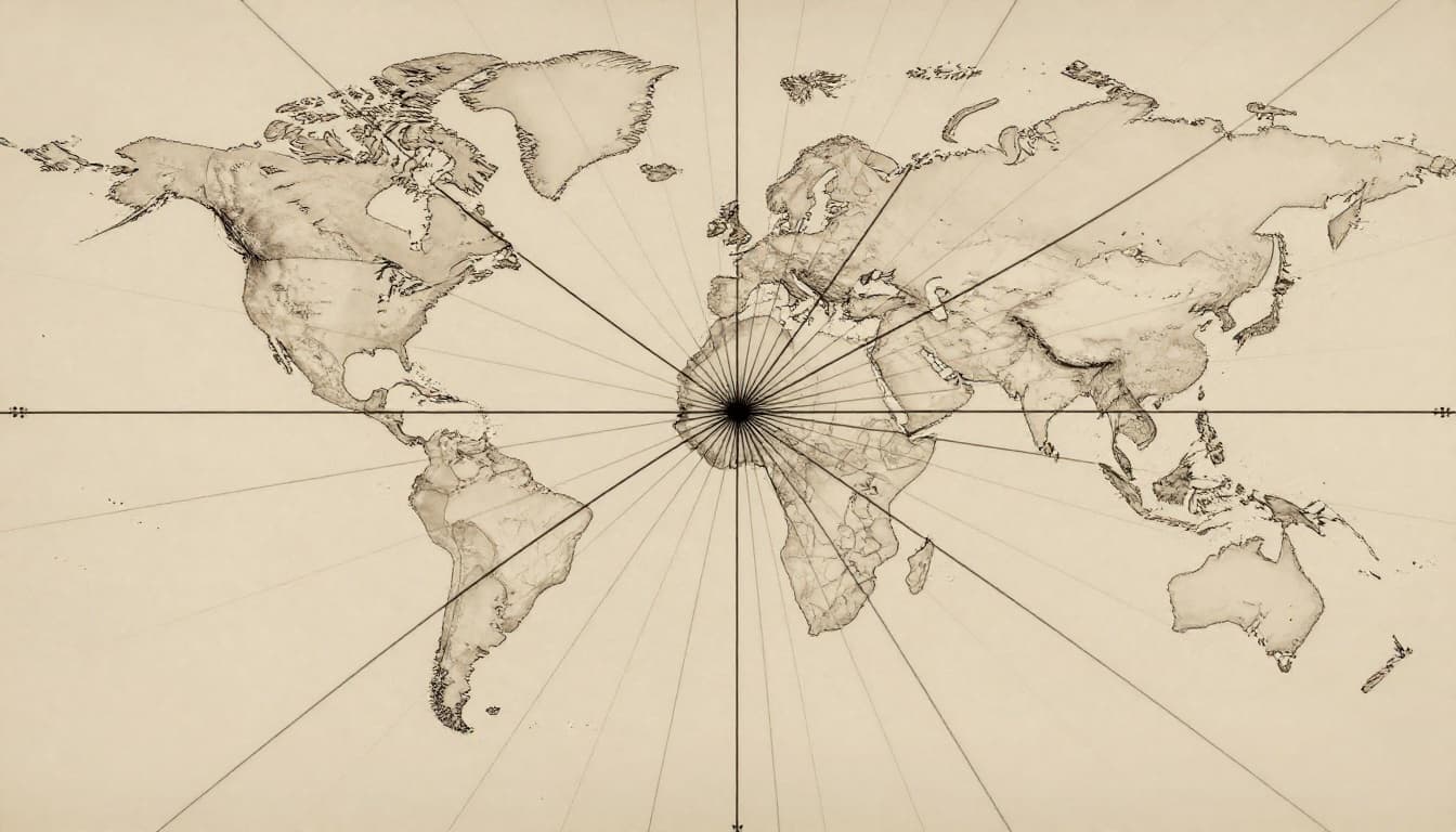
Imagine Earth with lines wrapped around it. Some lines run left to right, like belts around a planet. Others run up and down, like slices through the orange.
A big reason this works is symmetry. Latitude lines run east to west and help you measure north-south position. Longitude lines run north to south and help you measure east-west position.
Britannica describes these coordinates as a way to locate a point using two values on Earth’s surface. If you want a reference diagram, see latitude and longitude on Britannica. For a simple school-level explanation, BBC Bitesize on latitude and longitude also breaks it down with clear examples.

Here’s the quick mental model:
- Latitude tells you how far you are north or south of the Equator.
- Longitude tells you how far you are east or west of the Prime Meridian (in Greenwich, England).
And one more helpful visual rule: latitude lines never meet, but longitude lines meet at the poles.
To make the difference crystal clear, use this comparison.
| Feature | Latitude | Longitude |
|---|---|---|
| Main direction | North-South | East-West |
| Line style | Horizontal “belts” | Vertical “slices” |
| Starting line | Equator (0°) | Prime Meridian (0°) |
| Range | 0° to 90° N/S | 0° to 180° E/W |
| Rough distance per 1° | About 111 km (69 miles) | Varies by latitude |
That last row matters. Latitude degrees are almost the same distance everywhere. Longitude degrees shrink as you move toward the poles.
Latitude: The Horizontal Hula Hoops
Latitude measures your distance north or south from the Equator. The Equator sits at 0° latitude. Then latitude goes up to 90° north at the North Pole and 90° south at the South Pole.
So if a location says 40° N, you’re 40 degrees north of the Equator. If it says 25° S, you’re 25 degrees south.
These lines are evenly spaced around Earth, which makes latitude feel “steady.” Many maps use latitude bands to explain climate zones too. Places near the Equator often receive stronger sunlight year-round. Places closer to the poles get lower sun angles, so they’re usually colder.
A simple way to remember it is this: latitude tells you how far you are from the “belt” at the middle of Earth.
Longitude: The Vertical Lines That Meet at the Poles
Longitude measures your distance east or west from the Prime Meridian. The Prime Meridian is set at 0° longitude in Greenwich, England. From there, longitude runs to 180° east and 180° west.
Here’s the tricky part that makes longitude feel different. Longitude lines converge at the poles. That means one longitude degree covers a shorter real-world distance near the top or bottom of Earth.
Longitude also connects to time. One common rule of thumb is that Earth rotates about 4 minutes per degree of longitude. That’s one reason time zones track east-west position.
In short: longitude tells you which “slice” of Earth you’re in, measured from Greenwich.
Quick Comparison: Latitude vs Longitude
Latitude and longitude work like two directions of one address. They’re paired values, not competing ones. Also, order matters when you write coordinates.
- Latitude comes first, then longitude.
- Latitude runs east-west, measuring north-south.
- Longitude runs north-south, measuring east-west.
- Latitude degree distance stays similar, while longitude degree distance shrinks near the poles.
How to Read Latitude and Longitude Coordinates
Coordinates usually look like a pair of numbers with directions.
Most often you’ll see:
- Latitude first, then longitude
- Each has a degree symbol (°)
- Directions show as N or S (latitude) and E or W (longitude)
Think of it like dropping two lines from a map. One line tells you north-south. The other tells you east-west. Where they cross is your spot.
A quick math bonus helps if you see more detailed formats. One degree can be split into 60 minutes (written with ‘), and each minute can split into 60 seconds (written with “). In everyday life, you’ll most often see decimal degrees instead.
The Standard Way to Write and Say Them
A common format looks like 40.7° N, 74° W. That’s often how cities appear in maps.
If you see directions in writing, use them like this:
- Latitude: N means north, S means south
- Longitude: E means east, W means west
You might also see the same location in decimal form, like 40.7, -74.0. In that version, negative means west for longitude, and south for latitude.
If you want a simple “how to read it” refresher, What are latitude and longitude? at EarthChasers uses the grid idea in plain language.
Gotcha: Coordinates usually list latitude first. If you swap them, you can land in the wrong country.
Pinpointing Famous Places with Real Examples
Let’s try a few real coordinates so it feels less abstract.
- New York City: about 40.7° N, 74° W
- Equator (near Quito, Ecuador): about 0° S, 78.5° W
- North Pole: 90° N (longitude can be anything because all longitude lines meet there)
- London (near the Prime Meridian): around 51.5° N, 0°
- Your turn: look up your town or neighborhood, then read the pair out loud: “latitude, direction, then longitude, direction.”
If you want to see how coordinates link to time zones, major cities by latitude and longitude at Infoplease is handy. It shows how the east-west location connects to local time.
From Ancient Maps to GPS: History, Facts, and Myths
Longitude and latitude didn’t appear overnight. People needed them because travel was risky and landmarks could disappear.
Latitude was one of the easier parts to measure. Long ago, sailors could estimate it by using the sky. They measured the angle of the Sun or stars. Longitude was harder. The big problem was figuring out east-west position when you’re far from home.
One famous story is called the longitude problem. The Smithsonian’s The Longitude Problem at Time and Navigation explains why a reliable method mattered so much for ships.
Then clocks, charts, and global agreement pushed the system into a standard everyone could use.

A Short History of the Global Grid
A quick timeline helps:
- Ancient thinkers used sky observations to get latitude.
- Sailors struggled for centuries to measure longitude at sea.
- A major breakthrough came from using accurate clocks to track time differences.
- Later, global standards set landmarks like the Prime Meridian.
Today, we still rely on the same grid idea. We just use better tools.
In the US, GPS updates can change how coordinates line up with Earth’s exact shape. In recent years, the US shifted to an updated reference system, which can move coordinates by a few meters. That matters for surveying, farming, and construction.
Fun Facts and Memory Tricks You’ll Love
You can remember the “hula hoop vs ladder” idea:
- Latitude are your horizontal belts (hula hoops).
- Longitude are your vertical ladder sides (rungs run around, sides run through).
Another fun trick: think about where lines “meet.”
- Latitude belts always stay separate.
- Longitude lines always meet at the poles.
Time zones connect too. If you move east, local time usually increases. That pattern comes from Earth’s rotation and the east-west structure of longitude.
Common Mistakes and How to Avoid Them
People trip up in predictable ways. Here are the most common ones.
- Myth: “Longitude starts at the Equator.”
Actually, the Equator is latitude. Longitude starts at the Prime Meridian. - Myth: “Latitude and longitude lines are the same size everywhere.”
Latitude degrees stay close to the same distance. Longitude degrees shrink near the poles. - Myth: “The order doesn’t matter.”
For most map formats, latitude first. Then longitude. - Myth: “GPS coordinates never change.”
They can change a bit when reference systems update. That’s normal in high-precision work.
Latitude and Longitude Power Your Daily Tech
Once you learn latitude and longitude, you start noticing them everywhere. Your phone might not show the grid, but it uses the idea to locate you.
Here’s what’s happening behind the scenes:
- GPS satellites send timing signals.
- Your device compares those signals.
- Your phone calculates your position using latitude and longitude, plus height and timing corrections.
In the US, many devices now combine multiple satellite systems. That helps GPS work better in cities, under trees, and near tall buildings. You’ll also see improvements like more precise positioning in good conditions, and steadier results indoors when the phone blends sensors.
So when your app says, “Arriving in 3 minutes,” coordinates are part of the story. Food delivery, ride-share pickups, bike tracking, and even fleet routes use the same grid math.
Smart systems also use location to avoid traffic, plan routes, and update maps faster. In 2026, the tech often focuses on better reliability and better alignment with updated reference models, so the numbers land closer to the real spot.

Conclusion
Latitude and longitude explained simply means this: your location is a grid address. Latitude tells north or south from the Equator. Longitude tells east or west from the Prime Meridian.
Once you can read the format, coordinates stop feeling random. You can look at a pair of numbers and picture the exact crossing point on Earth.
And the best part is how useful it becomes. GPS apps, delivery tracking, and route planning all rely on the same two-value system.
Next time you check a map, try saying your coordinates out loud. Then ask yourself, “What spot on Earth would I land on if I changed just one number?”